The Problem

Developing Countries, especially in Sub-Sahara Africa suffer from a phenomenon called " Spontaneous Development". Spontaneous Developments are settlements (usually slums) around cities that spring up overnight. They are usually unplanned settlements. This makes it difficult to allocate physical addresses to the houses or habitations in them. Rural and semi-urban areas in Sub-Sahara Africa and other developing countries usually follow this pattern as well.
Unplanned settlements make it difficult to
Conduct trade and commerce as the houses cannot be uniquely identified
Provide basic services by Government such as hospitals and clinics, schools,
roads, drainage and sewage systems

Provide emergency services by government agencies such as fire outbreak, medical or health emergencies, disaster relief etc

The Trends

A massive number of people in Sub-Sahara Africa and other developing countries have mobile phones. This massive penetration of mobile phones means that a number of people can now communicate with each other. The majority of these people are also migrating their phone from Feature Phones to the low-end Android Smart Phones. Another trend is the massive uptake of mobile data. A Number of people now browse the internet on their mobile phones, with email, Facebook and messaging applications like WhatsApp being quite popular.

The Opportunity

The large number of mobile phones in use in Sub-Sahara Africa and other developing countries means that there is a very wide potential reach of millions of mobile phone users for mobile applications that can be used to solve challenges being faced in these regions. If broad acceptance of mobile application is achieved, it can become the de-facto platform for solving challenges in these regions.

The Solution

Nescrow Global Services Limited, a mobile application development company in Lagos, Nigeria has development a mobile application, based on the Google Android Mobile Operating System, which solves the problem of Unique Addressing of Physical Locations in Sub-Sahara Africa and other developing regions of the world. The Application is called the Global Positioning System (GPS) Assisted Locator Codes. These are known as GAL Codes. A GAL Code is a six digit code system that can be used as an address for any location, using that location’s GPS co-ordinates. The GAL Code is generated by translating the GPS coordinates of a location into a six digit code, which is permanent for a radius of 17 meters from the point of generation. This is for the size of an average plot of land. A number of developing countries suffer from inconsistent, complicated or inadequate addressing system. This can be frustrating, costly, growth-limiting and sometimes life-threatening for inhabitants of these countries.
Learn More

Screenshots

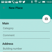
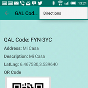
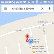
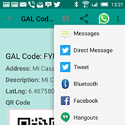
A peek into some of the features on GAL Codes Mobile app and Web platform

The Mobile App

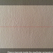
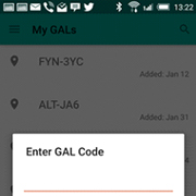
The GAL Code application has two parts. There is the mobile app for users and the web application for commercial and enterprise clients. The user app is free while the commercial/ enterprise application is billed on a per transaction basis. The features of the mobile app are as follows
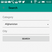
Home Menu Enter Category Enter Category Upon Generation Use Information Use Information Scan Code Menu Use Information Use Information Enter Code Menu About MenuLogout Menu

The Web Application

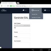
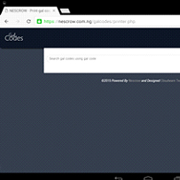
The GAL Code application has two parts. There is the mobile app for users and the web application for commercial and enterprise clients. The user app is free while the commercial/ enterprise application is billed on a per transaction basis. The web application, which is for commercial and enterprise use, has the following features;
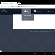
Home Menu Home Menu Generate Code Menu Print Code Menu Send Code Menu Use Code Menu Search Menu

The Industry Applications

GAL Codes can be used for the following.


Navigating to points of interest and places without an address can be challenging. People often want to navigate to somewhere that does not have an address. GAL Codes can solve these challenges as it is precise, independent and unambiguous addressing.

Delivery companies and ecommerce logistics require minimal delays and optimal routes. GAL Code makes it practical to deliver to businesses and individuals without addresses. In areas with poor addressing, this can increase delivery efficiency. With GAL Code, delivery companies don’t have to rely on drivers with local knowledge to make deliveries.

Communicating locations is key when responding to emergencies such as traffic accidents, fires, natural, humanitarian or environmental disasters. Too frequently, the inability to define the location of an emergency causes dangerous delay. GAL codes can transform emergency services’ ability to response quickly and efficiently to disasters.

Locating multiple and disperse assets is vital to maintaining operational efficiency for businesses and governments. Uniquely identifying and quickly locating multiple and disperse assets is vital to maintaining operational efficiencies, safety and profitability. GAL Codes can help the management of assets. Governments can also use the GAL Code to uniquely identify building for development and tax purposes.

Correctly identifying locations is crucial to effectiveness of humanitarian aid. Location management is key to the delivery of effective humanitarian aid or developmental services. Knowledge of the precise location of facilities, hazards, resources and boundaries is essential to the delivery of life sustaining support system for humanitarian field operations, especially in environments that are challenging and unaddressed.

The Typical Scenarios


These are some of the typical scenarios we envisage for the use of GAL codes in developing countries.

Logistics

Mama Beatrice lives in the village. She produces vegetables that are needed fresh in the city. With the use of GAL Codes, her transporter can pick up her produce and deliver it to the city merchants because he her precise location in the village and that of her merchants in the city Her transporter also delivers goods sent to her by her son in the city.

Emergency Services

There has been an outbreak of a communicable disease in Mama Beatrice’s village and the government needs to immunize all the inhabitants. With the GAL Code of Mama Beatrice’s home, the health officials can easily locate her and administer the needed immunization in a timely and efficient manner.


Get it on Google Play

Want to Deploy a Nescrow product?

We would like to hear from you. Contact us for any inquiry and we will be glad to listen to you.

Contact us